A Detailed Look
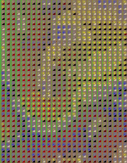 |
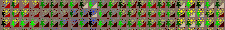
GIS icon maps work best in colour and when viewed electronically, lend themselves to dynamic exploration of multivariate interrelation. Macro views reveal general trends and patterns, while micro views stimulate local interpretations and hypotheses.
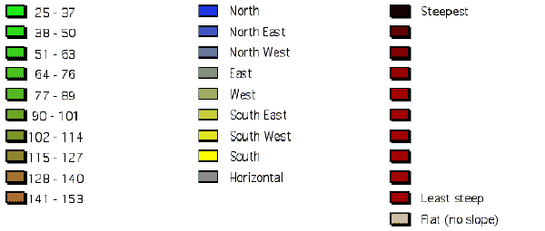
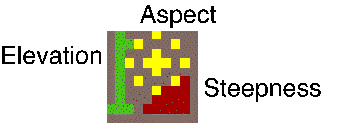
Elevation is represented by the 'flagpole' symbol. Higher values are brown while lower elevations are green. The Orientation variable is represented by a 'sun' symbol. Southerly facing slopes are yellow. North facing slopes are blue. The Steepness variable is represented by the 'stepped slope' symbol. Steeper values are bright red (see legend below).
|
LEGEND
Elevation |
Aspect |
Steepness |