The First Five Decades: 1953 to 2003
Extending from Wernher von Braun's Mars Project to Mars Express and Beagle 2.
Philip J. Stooke
Cambridge University Press
Expected publication date: Late 2012

Photomap of the Viking 1 sample field (P. Stooke)
Bringing together a wealth of information from many sources, including much material never before published, this atlas is a comprehensive reference on Mars exploration. It tells the story of every spacecraft mission to Mars since the dawn of the space age, illustrating each account with a unique combination of maps and annotated photographs. Many of the illustrations were created especially for this atlas. The missions and events are listed in chronological order, providing readers with an easy to follow history of Mars exploration missions. Special attention has been given to describing the selection of landing sites for every Mars mission, flown or planned. Landing site activities such as sampling at the Viking sites or rover activities at the Pathfinder site are thoroughly documented.
- An easy to follow, step-by-step history of Mars exploration in atlas format.
- Compilation of information from many sources, including material never before published.
- Most illustrations were created especially for this atlas.
- Foreword by Matt Golombek (JPL)
A few examples of the contents:
Pioneer Mars network site plan.
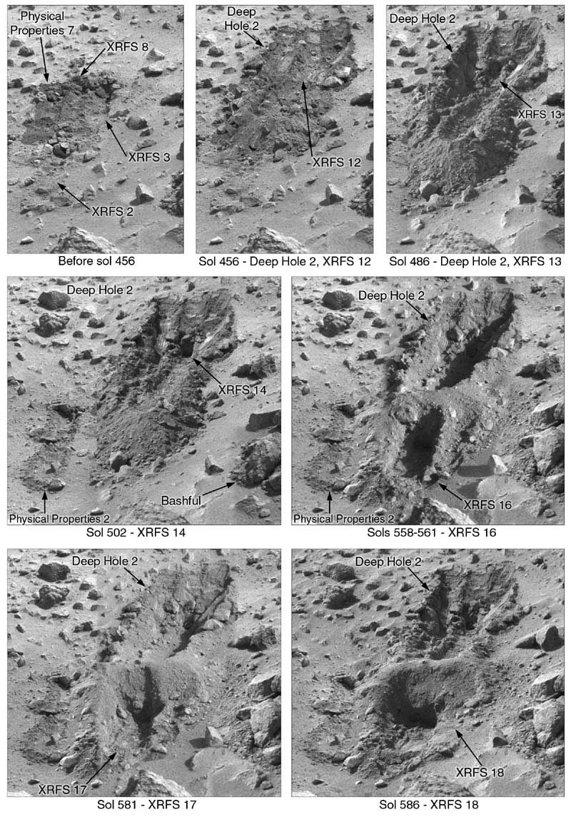
Viking 1 trenching activities.
Mars 4 image coverage.
Mariner 7 image coverage.
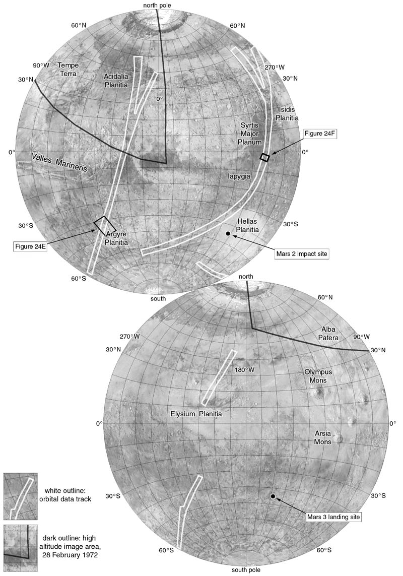
Mars 3 data coverage.
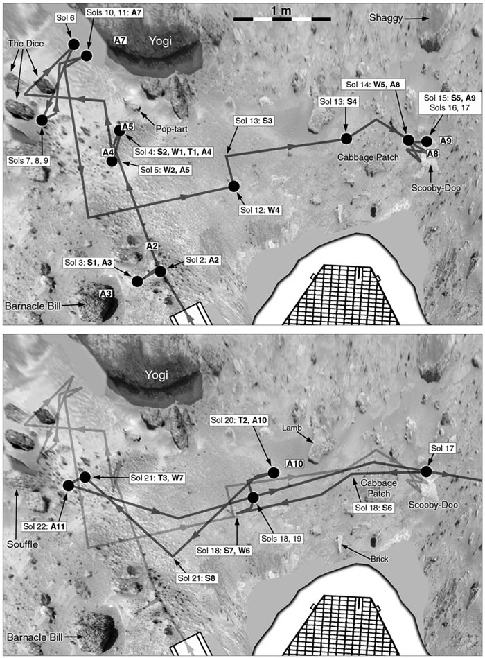
Mars Pathfinder - Sojourner rover activities, sols 2-23.
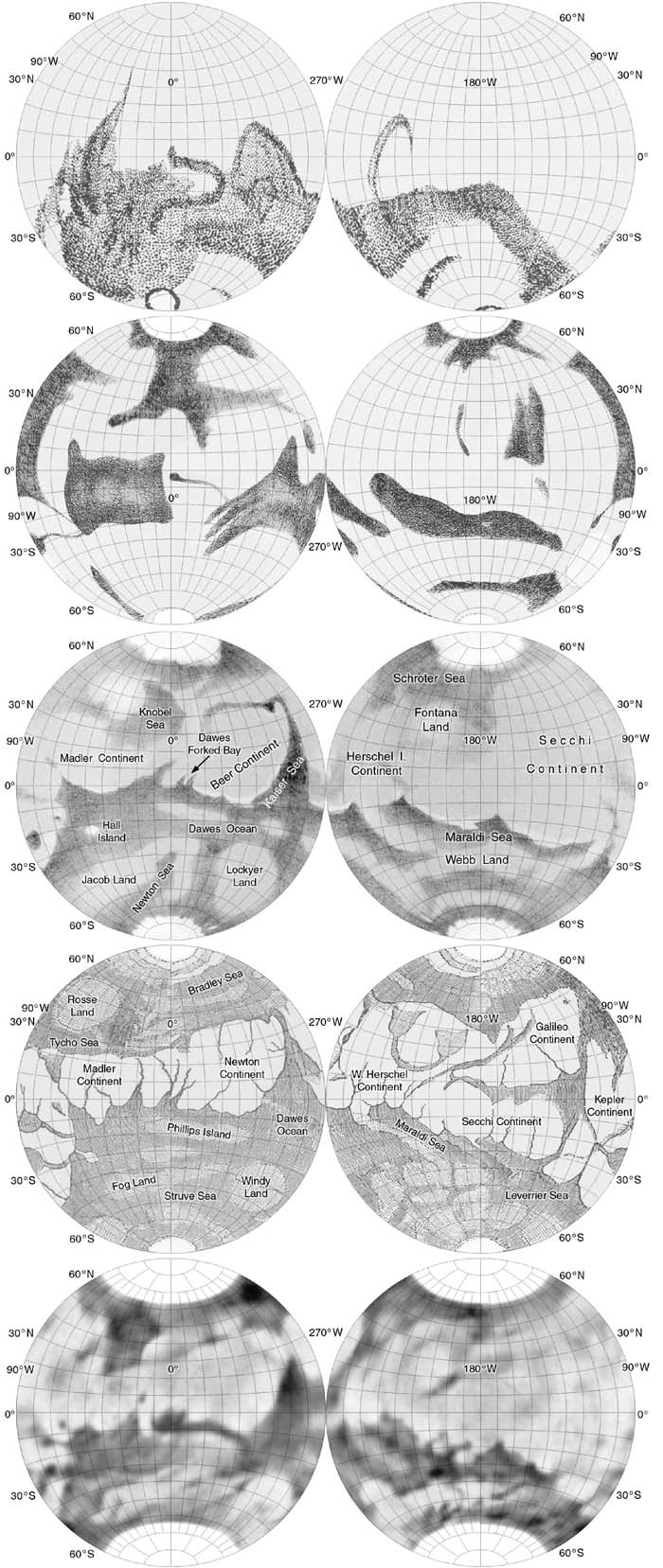
Early maps of Mars by (from top) Herschel, Beer and Madler, Green, Proctor and Mottoni
e-mail the author: pjstooke@uwo.ca
author's website: publish.uwo.ca/~pjstooke
Philip J. Stooke
Department of Geography
University of Western Ontario
London, Ontario, Canada N6A 5C2
November 2011